Smart Port & Harbor Solution

Create a clearer operational picture for harbor teams with weather, wave, water-quality and visual monitoring tied into one reporting workflow.

What's the Problem?

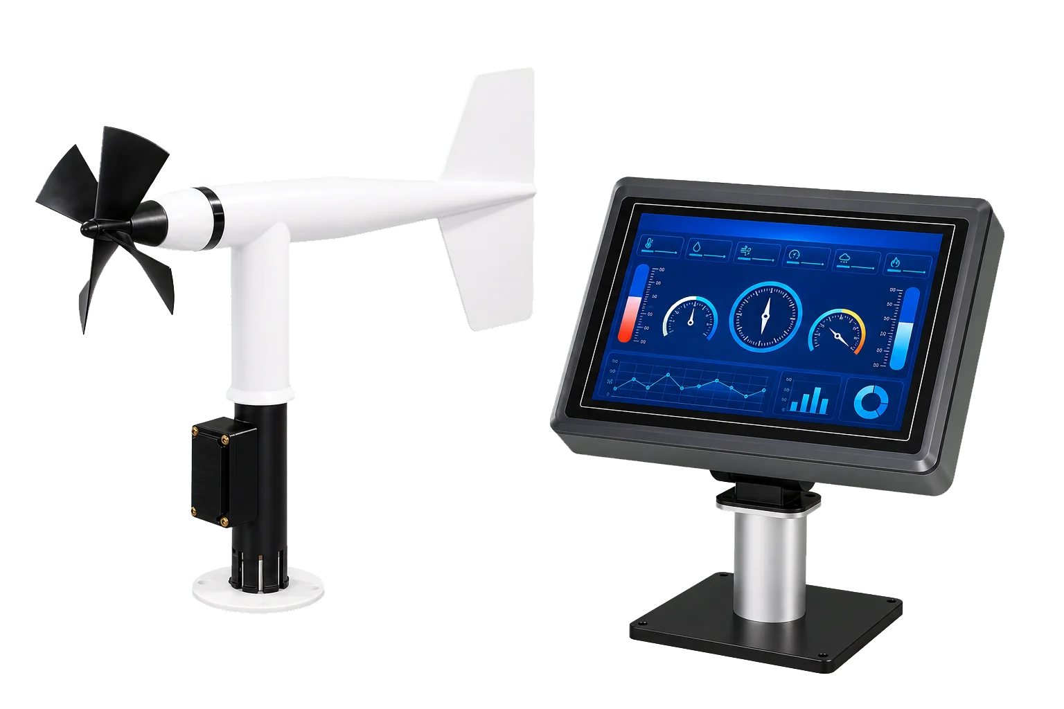
Ports and harbors need local environmental data to support safe vessel movement, waterfront operations and incident response.

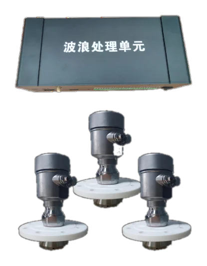
  • Wind and wave conditions can change faster than broad regional forecasts capture
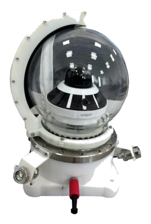
  • Waterfront teams often need both environmental and visual confirmation
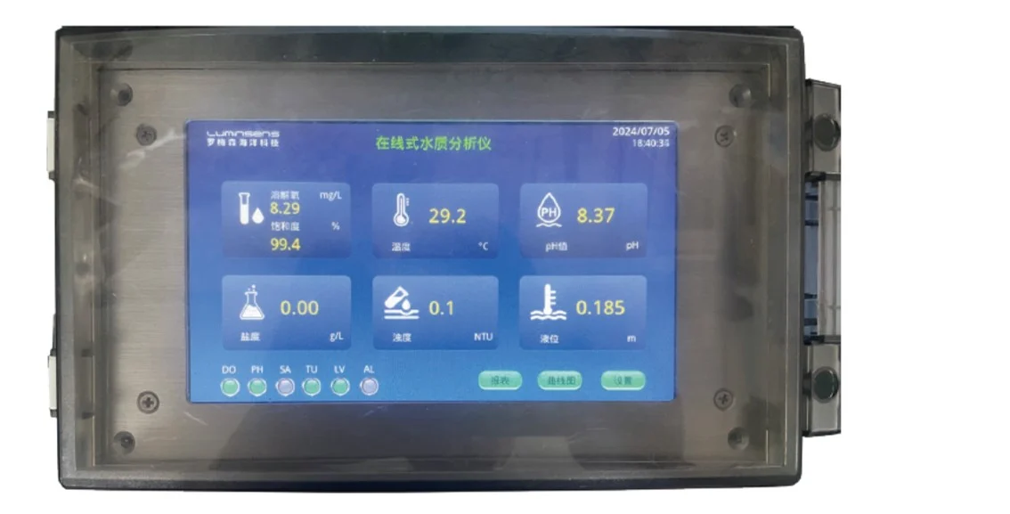
  • Water-quality incidents near berths, outfalls or terminals demand faster detection
  • Separate systems create delays during operational decision-making

What's the Challenge?

Harbor infrastructure is busy, space-constrained and exposed to corrosion, vibration and electromagnetic noise. Monitoring systems need to be compact, dependable and easy to interpret.

  • Stations may need to mount on bridge structures, quays or service towers
  • Operators need fast-glance displays, not only raw data feeds
  • Visual confirmation can be as important as the measurement itself
  • Monitoring must integrate with routine operational workflows rather than sit beside them

Our Solution

Zenocean combines weather instruments, wave sensors, online water-quality analyzers and panoramic imaging so port teams can move from environmental data to action faster.

  • Measure the harbor environment at the point of operation
  • Combine data and visual context for faster interpretation
  • Add online analyzers where berths, canals or outfalls require water-quality oversight
  • Scale from single critical berths to a wider harbor network

How Zenocean Delivers the Smart Port & Harbor Solution

AeroSense-MarineBridge display unit

1. Watch Harbor Weather

AeroSense display systems give port teams immediate visibility of local wind conditions where ships and cranes operate.

WaveSense-R harbor wave sensor

2. Track Waves and Water Level

WaveSense-R provides non-contact wave and water-level awareness from fixed structures near channels and berths.

AquaSense-DOX water-quality analyzer

3. Add Online Water Quality

AquaSense analyzers support continuous checks where discharge, runoff or enclosed basins need closer oversight.

PanoCam-360 imaging system

4. Add Visual Awareness

PanoCam-360 complements instrument data with panoramic underwater or near-asset visual confirmation.

Operational dashboard for harbor monitoring

5. Share the Operating Picture

Dashboards and alerts turn local sensor feeds into an operational view that marine, safety and engineering teams can share.

Why This Stack Fits Harbor Operations

Harbors rarely need just one parameter. The current catalog supports operational weather, water movement, water quality and visual context in one solution frame.

Operationally Practical

Display-friendly instruments help teams use the data during real daily port activity.

Local, Live Conditions

Measurements are taken where maneuvering and port work actually happen.

More Context per Event

Wave, weather, analyzer and imaging layers help teams interpret conditions faster.

Fits Critical Nodes First

Start at key berths or channels, then expand to a broader harbor network.

Need a smarter harbor monitoring layout?

We can match the current weather, wave, analyzer and imaging products to your port operating priorities.